Effective biodiversity research and management relies on comprehensive information about the species or ecosystems of interest. By bringing together biodiversity data from multiple sources and making it freely available and usable, the ALA helps researchers access data to discover answers to their questions.
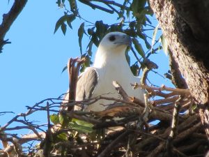
An example is the Coastal Raptor Nests project in Redland City, Queensland. Raptors are vulnerable to threats such as climate change, pollution and urban development. The project utilised community members to help observe and identify raptor nests.
ALA tools were then used to collect and make the observations accessible. Data from Terrestrial Ecosystem Research Network (TERN) was used to create species distribution models for each raptor species through the Biodiversity and Climate Change Virtual Laboratory (BCCVL). The resulting models looked at both current and future climates.
The ALA, TERN and BCCVL are all funded by the Australian Government’s National Collaborative Research Infrastructure Strategy (NCRIS). The ability to collect and analyse data using several of the connected NCRIS facilities has allowed Redland City Council to create an informed raptor management plan to help ensure longevity of the species in Redland City.
This article was compiled by NCRIS projects to highlight how NCRIS infrastructure is being used to deliver meaningful, useful, real world impact. This article can also be found in the The Impact of NCRIS: Supporting Research and Innovation Through Data Access brochure and the most recent TERN eNewsletter. Stay up-to-date with NCRIS impact stories on Twitter via #NCRISimpact.